


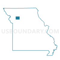
Hamilton Voting District, Caldwell County, Missouri
About
Outline

Summary
| Unique Area Identifier | 607289 |
| Name | Hamilton Voting District |
| County | Caldwell County |
| State | Missouri |
| Area (square miles) | 16.99 |
| Land Area (square miles) | 16.79 |
| Water Area (square miles) | 0.19 |
| % of Land Area | 98.86 |
| % of Water Area | 1.14 |
| Latitude of the Internal Point | 39.74662910 |
| Longtitude of the Internal Point | -94.06616920 |
Maps


Graphs
Select a template below for downloading or customizing gragh for Hamilton Voting District, Caldwell County, Missouri


Neighbors
Neighoring Voting District (by Name) Neighboring Voting District on the Map
- Gomer Voting District, Caldwell County, MO
- Kidder Voting District, Caldwell County, MO
- Kingston Voting District, Caldwell County, MO
- Mirabile/Rockford Voting District, Caldwell County, MO
- Wesley Chapel Voting District, Daviess County, MO
- Winston Voting District, Daviess County, MO
Top 10 Neighboring County Subdivision (by Population) Neighboring County Subdivision on the Map
- Hamilton township, Caldwell County, MO (2,382)
- Kidder township, Caldwell County, MO (1,081)
- Kingston township, Caldwell County, MO (623)
- Colfax township, Daviess County, MO (613)
- Mirabile township, Caldwell County, MO (388)
- Sheridan township, Daviess County, MO (384)